Tuesday, 18 October 2011

The route in pictures


http://www.gmap-pedometer.com/?r=5071510
If you are a memberof the Good Run Guide website:
http://www.goodrunguide.co.uk/RunDetails.asp?RunID=2408#


Click on the pictures to enlarge them.
Start from the Kingston Gate car park in Richmond Park, cross the road and go up this path through the trees. There are optional steps.
At the top, turn to the left.
Follow the treeline.
Turn right onto this faint path across the grass. The path becomes more defined as you get nearer the trees opposite.
Follow a well defined path through the trees. Wherever it forks keep going in roughly the same direction.
Round this fenced area...
Along here...

and follow the path all the way to the entrance to Isabella Plantation (above).

Take the main path straight ahead of you. If you stay on the major gravelly path and keep heading down the slope you will inevitably come to the pond at the bottom, next to which is a gate leading out to the disabled car park.
Exit Isabella Plantation


Turn hard right and take a straight path which crosses the open area and joins a broad tarmac path with a bridleway next to it (shown below).


Turn right and follow that path until you reach a wood on the left.
Branch off the tarmac path and follow the edge of the wood on the track visible in the centre of the picture above.
You come down a slight slope, and through the few trees shown below.

The path crosses a ditch and curves round to the left to come to Pen Ponds. Follow the edge of the first pond and cross the causeway between the 2 split level ponds, and then turn left to go back along the other side of the upper pond.


Follow the path straight. Where it forks at the point shown above, continue on the right hand fork.
The path crosses an open area. Ahead you see a dense belt of trees on the horizon. The path will take you to the right of the densest area of trees.


You emerge onto a road (below).


Cross the road and continue on the path opposite which curves to the right, and then two paths fork off on the left.
 Take the second of them (shown above) which leads down to Ham Gate and out of Richmond Park.


As you leave Richmond Park there is a large white property on the left, after which is Church Road. Take the track which is shown above, to the right of the road sign.
Follow the track roughly parallel to the road until it emerges by the traffic lights at Ham Common.
Cross the road and run across the Common, skirting round the edge of the pond on the far side. 


Go down Lock Road (above).
At the end of Lock Road (shown above) turn right,

and after a few yards turn left down an alleyway, shown below.


At the end you cross a road and continue down a path, shown below.

Cross the road at the end and continue on a path which leads you to Teddington Lock.
Turn left at the river and follow the towpath down in to Kingston.

You briefly join a road which leads past the Sea Scouts, then branch off to stay next to the river at the point shown above. Go past Boaters pub and Canbury Gardens, under the railway bridge, to meet another road. You are next to the river all along this stretch so you cannot go wrong.


Take the brick path shown above, past John Lewis,


and go up the stairs visible in the centre of the picture above, which take you onto Kingston Bridge. Cross the river, then cross Kingston Road at the zebra crossing, turn left and go past the White Hart pub, and turn right into Church Grove. After 20 yards cross the road and go through the iron gate (shown below in the gap between the cars) just past the skateboard park.


That path goes between the skate park and allotments, then into Bushy Park.

Follow the grass path going diagonally into the park
Keep in as straight a line as possible
This path leads to the car park at Heron Pond. Go through the car park and take the track which leads out of the far right corner. This goes over a footbridge and brings you to Chestnut Avenue. Cross that road and continue on the path which leads into the Woodland Garden. 
Take the path up to the Pheasantry cafe (a good place to meet supporters), then cut across the lawn to pass the pond,
turn right, There is a bridge which is now closed off, so I have to amend those directions. As soon as you go through the gate, turn left so that the long pond is on your right, and keep on the right hand path wherever the path divides
 until you come to the exit gate.


As shown in the map above.


Leave that garden and cross to the Waterhouse Plantation opposite. 


Again take the right hand paths as shown on the map above


and these photographs.


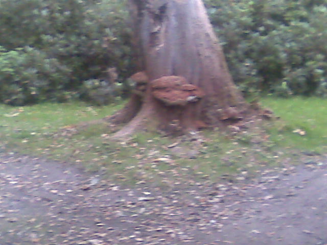
As you go round this small pond where you can see the house shown above,


you reach this long straight track shaded by trees. This takes you to the top end of the Waterhouse Plantation.


Exit the garden at the top end via 2 sets of gates and turn left. Follow the path as it runs parallel to the fence until you get to the point shown below, where you branch off to the left into the Water Garden.


Go round the Water Garden


and out the other end and follow that path as it curves round the buildings and then intersects Cobbler's Walk, the main asphalt path that runs through the middle of Bushy Park.


Turn right on Cobbler's Walk and follow it until you reach Chestnut Avenue, the main thoroughfare for traffic through the park. Turn right and run parallel to Chestnut Avenue, skirting Diana Fountain and exiting the park at the southern end.


Cross the road at the zebra crossing and go into Hampton Court at the Lion Gate.
Turn right past the Maze and continue to the buildings and wall.
Turn left and follow the wall until you get to a gateway.
Go through and on the other side of the wall turn left, through the rose garden and across the front of the palace, and out of the gate opposite which comes out on the river.


Turn left and follow the river path until you come to the Jubilee Gate, shown below.

Go through this gate and then a second, into Home Park.
Follow the path shown above, across a golf course, past a pond, along a short stretch of tarmac and so to the Long Water, all of which is a fairly straight line.


Turn right and go to the end of the Long Water.


Turn slightly left, cross the road and follow the grass path shown below. (Follow the line of my shadow to where it intersects the road and you will see a green line which goes between the gap in the trees.

This path crosses a rabbit warren (mind your footing)

and then joins a tarmac path heading slightly left. Follow that path and it will lead you out of Home Park (across the cattle grid).
Turn hard right and stay on the pavement over Kingston Bridge.
Go down the steps to the riverside before reaching the shops.
Turn and go under the bridge and re-trace your steps along the riverside, under the railway bridge and into Canbury Gardens.

Turn right into King's Passage as shown above. (If you get to that blue bandstand you've gone too far).
Keep going in as straight a line as is possible, up Lower King's Road, cross the Richmond Road (take care here, wait for the lights), and up Kings Road past the Richmond Park pub, across Park Road, and finally back to Kingston Gate.

Go into the park, then follow the cycle path up the eastern edge of the park (this is the longest hill on the course), all the way to Robin Hood Gate.


Exit Richmond Park at Robin Hood Gate, turn right to the pelican crossing, cross the road and then take the footbridge over the A3.
On the other side of the bridge turn hard left and over a narrow track over a low mound, and into a small grassy area. Ahead of you there is a small bridge with red brick parapets, over the Beverley Brook.


Cross this bridge and enter a large playing field with several rugby and football pitches.


In the opposite corner is a circular hedge with trees inside. Skirt anticlockwise around two edges of the field.


Go in through the gap in the hedge nearest you

 and follow the path to this imposing war memorial in the centre.
 Turn right and another path takes you out of the circle, and onto Wimbledon Common.


The above photos show what you see as you enter Wimbledon Common. Turn right onto the path you see behind the tree on the right of the picture, and then immediately left again, uphill.


After about 30 yards the path forks as you see above. Take the left hand fork.


You can be sure you are following the right path by following this Capital Ring sign, on the post to the left of the tree where the path forks.


At the top, you emerge onto a golf course, with this white and yellow sign reminding you to take care crossing the fairway. Keep following the path.


You go through this patch of trees and cross a second fairway.


On the other side the path splits like this. Take the path straight ahead in this photo. It is actually the middle of 3 paths, the third being out of shot further round to the right. Note the Capital Ring signpost.


At the bottom, you reach the Queensmere pond. Turn hard right when you reach the pond and up a very straight path leading to a Golf Clubhouse.


Turn left at the top (shown above), round the side of the clubhouse, and you reach the Windmill car park. Turn right and cross the car park.

Cross the grass
 and turn onto the 2nd path on the left you can see in the picture above. 
(This is the 2nd path, the 1st path diverges off to the left, whereas the 2nd one is straighter.) 
 Follow the path all the way up to Tibbets Corner at the northern tip of the Common. Ignore the path on the left shown above.
For much of the way you will see a parallel path on your left.

At the point shown above cut across to the left hand path. If you miss it there are 2 more paths which cut across, as indicated by the arrows above.


You will emerge from the woods at this point and the Tibbets Corner underpass begins where the path disappears in the photo above.
Go to the right before you get to the underpass,


and follow the path round to the right. You will be close to the roundabout here.

 
Follow the path for about 200 yards 


and turn right where another path crosses the one you are on.


As you come out from the trees, the track crosses the one you ran up earlier,

and leads to Kingsmere Pond.
Pass Kingsmere Pond on your right.
(The paths round Kingsmere Pond.)
Then leave the pond by taking this path shown above.
The track enters a wooded area with no undergrowth so you see all the tree trunks on either side of the path.


A path crosses the one you are on, but take the path opposite and a few yards to the right, just visible under the leaning tree in the picture above. (The tree is no longer there).


(Note the No Cycling post on the right of the track.)
Follow this path up and round, over a small hillock.


Turn left when you reach this wider grassy path below.


It passes the East Surrey Regiment memorial (several yards to the right of the path)

and then goes over a couple of undulations (rather steep!)


When you come down the other side, there is a grassy clearing with woods each side.
Descend to the right,


and take the path through the woods which leads back to the Windmill car park.


 Cross the car park and go round to the other side of the Windmill,

past these gear wheels and to the right, 
 where you pick up the main bridle path leading south through the Common.
 Continue on it straight for about half a mile.
Then turn left onto another large broad bridle path (junction shown above).

 Continue straight on this until you near the edge of the Common,
 Turn left again a few yards before reaching the posts across the track, seen in the picture above. The new track runs roughly parallel with Cannizaro Road.
After ~30 yards you come to a junction of 3 paths. Take the middle one which leads diagonally back in to the middle of the Common, through the trees. (The left hand path is obscured in the photo above.)

 Note the No Cycling post on the left.

This path leads straight back to the Windmill.

At the Windmill cross the green area with the log pile on your right, and pick up the path that runs parallel to the hedge. Take the path downhill, back to Queensmere Pond. (You came up it earlier.)

Do a lap round Queensmere Pond, then retrace the paths you took coming into Wimbledon Common, across the golf course and back to the big war memorial.

Go to the right of the hedge round the war memorial, but stay inside the playing fields.

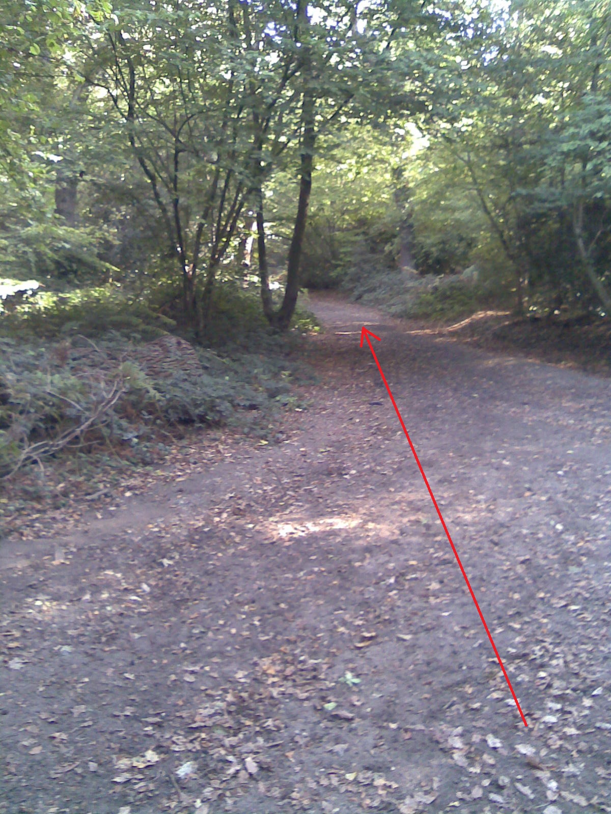
Go round the other 2 sides of the playing fields you have not run along before.

Exit the playing fields the way you came in, and exactly re-trace your steps back over the A3 and back into Richmond Park.

In Richmond Park, as you come through Robin Hood Gate you come to a mini roundabout (shown below). Go across the roundabout (carefully) and follow the line of the road (much quieter than the perimeter roads).
and where it starts to curve right and head uphill to the car park, branch off it and onto the bridle path (continuing initially in a straight line).
Pass an isolated clump of trees on the right.

After a while the bridle path broadens out to become a track, and then curves slightly right, and then joins a tarmac path (shown below where the arrow curves left).
 Continue in the direction you were going on that path. You were on this path in the opposite direction earlier, between Isabella Plantation and Pen Ponds.
This path ends at the perimeter road. Cross the road (carefully) and take the track opposite (shown below).
which leads down to Ham Gate again.

At Ham Gate turn left and follow the cycle path round the perimeter back to Kingston Gate. Cross the road carefully and go to the car park and the finish.


Hooray!


Sunday, 25 September 2011

http://www.gmap-pedometer.com/?r=5071510

Well here it is finally: - the route of the South West London Green Spaces Marathon, aka the Wildlife Marathon, aka the Parakeet Marathon, aka the Alternative London Marathon etc etc. Go to:

http://www.gmap-pedometer.com/?r=5071510


It comes in at slightly more than 26.2 miles as drawn, and the actual length of the paths through tree covered areas like Isabella Plantation & the Woodland Gardens in Bushy Park have not yet been measured accurately. So I anticipate a bit more tweaking to try to get the distance a bit closer to the official length of 26 miles and 385 yards. But it’s going to be pretty much what I have drawn. The route starts at the car park at Kingston Gate in Richmond Park, and goes first to Isabella Plantation, then Pen Ponds, then down to Ham Gate and out through Ham to the river. It turns left and up the river to Kingston, across the bridge and into Bushy Park. It crosses Bushy Park diagonally to the Heron Pond, through the car park by the Diana Fountain, and follows the path across the little footbridge, over the road and into the eastern Woodland Garden. It comes out at the other end of that Woodland Garden and into the western Woodland Garden. It exits at the northern tip of that garden through the 2 sets of gates, turns left and follows the fence line north until it reaches the new Water Gardens. It goes through the Water Gardens and out the other side then turns right and follows the path until it reaches the main path known as Cobbler's Walk. It then follows Cobbler's Walk until it comes to the broad area of cut grass which flanks Chestnut Avenue. It takes a path to the right down past the Diana Fountain and out the southern end of Bushy Park. It crosses the road and into Hampton Court, past the Maze on the right, through a gateway in the wall and turns left past the rose garden. It crosses the front of Hampton Court and out of the pedestrian gate onto the river again, turns left and round the side of Hampton Court and the formal gardens. It goes in through Jubilee Gate and then a second gate and into Home Park. It crosses the golf course and stays on an obvious path past a pond, until it reaches the Long Water. It turns right and follows the Long Water to its end, then crosses the golf course road, goes past the Overflow Pond and continues on the path until it exits Home Park. On leaving Home Park the route turns hard right, back to Kingston Bridge, across the bridge and down the steps onto the river again, through the tunnel under Kingston Bridge, and along the river, through Canbury Gardens and turns right into Kings Passage a few metres before the Bandstand. It keeps going all the way up Lower Kings Road, then Kings Road, back to Richmond Park. On re-entering Richmond Park, the route then climbs the hill and along the eastern stretch of the perimeter track of the park round to Robin Hood Gate. It goes out of the gate, over the A3 using the bridge, round the edge of a sports ground, into a ring of hedges and trees with a large war memorial in the centre, and into Wimbledon Common. It follows a track up to the golf course, across 2 fairways and down to Queensmere pond, then turns right up another track to the Windmill. From the Windmill it takes the path up to the northern tip of the Common, loops round to the left and follows a track to Kingsmere pond. It goes through some woods, then over some other paths, past the East Surrey Regiment monument, and back to the Windmill. It then follows Windmill Road and turns left on a main path and continues on a couple of fairly straight paths round the southern half of the Common and back to the Windmill. It then takes the same route back out of the Common to Richmond Park (except for looping round the other 2 sides of the sports field). It includes a loop round Queensmere, but this may be taken out if some distance needs to be shaved off. When back in Richmond Park the route runs alongside the road which heads to the centre of the park, but where the road curves right to head uphill to the car park, the route carries on straight on a bridle path until it reaches the road that leads back to Ham Gate. At Ham Gate it turns left and follows the path straight back to Kingston Gate car park and the finish.

Sunday, 4 September 2011

Wildlife Marathon


One if the reasons I am creating this marathon route is my love of nature. It is not a course designed for running a personal best time. It is designed for getting closer to the natural world, even in the midst of one of the world's major capital cities.
Something that made me very proud recently was when some people we know came over from New York, and stayed with us as part of a whistlestop tour of Europe. We had time for a brief visit to Hampton Court one morning and when we returned to the car in Bushy Park, to our guests’ amazement we saw a small herd of fallow deer. I suggested we go closer to get some photographs. We sat still on some logs, and the deer gradually came right up to us, quite unconcerned. We didn’t pet them or feed them, and as soon as enough photographs had been taken, we backed slowly away. Our guests said it was the highlight of their stay, and were astonished that it was possible to have an expeience like that in London. It was like being on safari.
So my suggestion is that, if this is to be run by more than one person at the same time, they each take a camera with them and photograph whatever interesting wildlife they see on the way round. Then get someone independent to judge who has taken the best photograph and declare that person to be the winner. It’s not about being the fastest from A to B. Completing the distance is acheivement enough in itself. It’s about taking the time to appreciate what we have right here.
Many mobile phones nowadays have cameras, and I hardly need to explain to someone experienced enough to be considering running this route, that it is a good idea to carry one when running on your own. I carry one in a small pouch on my arm and it does not interfere with my running. I have been practising taking photographs whilst on training runs, and am including some of my results here. Many of my efforts suffer badly from camera shake, but some are respectable, I hope you will agree.